
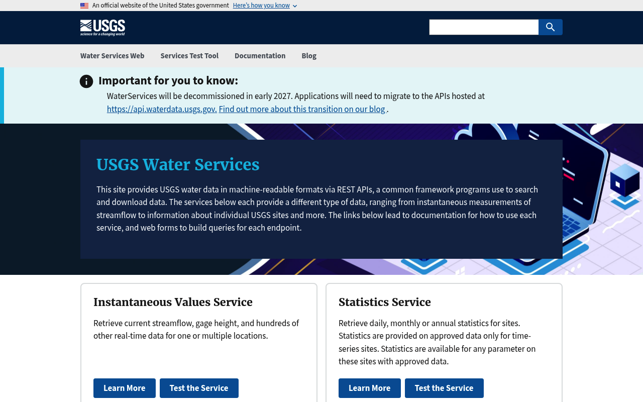
USGS Water Services
The U.S. Geological Survey (USGS) National Water Information System (NWIS) exposes a suite of REST APIs providing access to real-time and historical water data from over 1.5 million monitoring locations across the United States and territories. The legacy WaterServices APIs (being decommissioned in early 2027) and the next-generation api.waterdata.usgs.gov OGC-compliant APIs together cover streamflow, groundwater levels, water quality, site metadata, and statistical summaries. All services are free, publicly funded, and require no authentication for standard use; API keys are available at no cost for higher rate-limit access.
Limited machine-readable signal and partial portal coverage — documentation a human can read, but little a machine or agent can consume without scraping.

API Evangelist profiles USGS Water Services the way a machine reads it — 126 machine-readable artifacts across 1 API, pulled from the provider's own public surface and indexed so a developer, an analyst, or an AI agent can evaluate it against every other provider on the network.
Every provider in the network is reduced to the same set of machine-readable artifacts — OpenAPI contracts, event specifications, GraphQL schemas, runnable collections, pricing and rate-limit signals, security posture, OAuth scopes, and the agent surfaces (MCP servers and skills) that let software drive the API on its own. We profile them because the interface is the part of a company you can actually inspect: it is a truer signal of what a provider does than any marketing page. From those artifacts we compute the Kin Score — USGS Water Services scores 37.4/100 (thin), with a separate agent-readiness read of 20/100 (agent aware). The full breakdown is below, followed by every artifact we hold — each card links through to its machine-readable definition on apis.io.
Kin Score
This is the API Evangelist rating — a single, repeatable read computed from the artifacts on this page. Green fill is points earned; the red track is points possible, so every bar shows earned-versus-possible at a glance. Every facet and dimension name is a link: it opens that measurement's page on APIs.io, where the rating runs across the whole catalog — the exact checks that feed it, how every profiled provider distributes on it, and who is at the top of it.
Kin Score
How this is scored →scored 2026-10-17 · rubric v0.24.0

Put this on your own site. The badge is drawn live from USGS Water Services's current Kin Score — paste it once and it updates itself every time the score is recomputed. It follows your visitor's light or dark setting, and it links back here so anyone who sees it can read the full breakdown.
<!-- Kin Score · API Evangelist -->
<a href="https://providers.apievangelist.com/providers/usgs-water/"
   title="USGS Water Services on API Evangelist — API profile and Kin Score">
  <img src="https://apis.io/badge/usgs-water.svg"
       alt="USGS Water Services Kin Score — API readiness rating by API Evangelist" width="150" height="150" loading="lazy">
</a>[](https://providers.apievangelist.com/providers/usgs-water/)<!-- Kin Score · API Evangelist -->
<a href="https://providers.apievangelist.com/providers/usgs-water/"
title="USGS Water Services on API Evangelist — API profile and Kin Score">
<img src="https://apis.io/badge/usgs-water/card.svg"
alt="USGS Water Services Kin Score — API readiness rating by API Evangelist" width="340" height="120" loading="lazy">
</a>More shapes, themes and sizes → · Score as JSON · How badges work
How we profile USGS Water Services
Each block below is one kind of artifact we hold for USGS Water Services. For each we say what it is and why it earns a place in the profile, then list every one we've indexed — capped at two rows, scroll within the panel for the rest.
APIs 44
Each API is captured as its own OpenAPI definition — every operation, parameter, and response. This is the single most useful machine-readable description of what an API does, and it's what lets us score, lint, mock, and generate against it without asking the provider for anything.
Individual APIs this provider publishes, each with its own machine-readable definition.
USGS Instantaneous Values Service
Provides near real-time water data — streamflow, gage height, temperature, specific conductance, and hundreds of other parameters — from thousands of USGS monitoring sites. Valu...
USGS Daily Values Service
Returns historical summarized daily hydrologic data (mean, median, maximum, minimum) for streams, lakes, estuaries, and wells. Many sites have more than 10 years of record. Supp...
USGS Site Service
Searches and retrieves metadata for millions of USGS hydrologic data collection sites including streams, springs, wells, lakes, reservoirs, estuaries, and glaciers. Filtering op...
USGS Statistics Service
Retrieves daily, monthly, or annual statistics (mean, minimum, maximum, median, and percentiles P05–P95) computed from approved historical time-series data. Supports up to 10 si...
USGS Groundwater Levels Service
Provides historical manually-recorded groundwater level measurements from USGS wells and monitoring sites. Returns depth-to-water and water-level-above-datum values in JSON or R...
Water Quality Portal (WQP) API
A cooperative service sponsored by USGS and EPA providing access to water quality data from over 400 agencies including USGS NWIS and EPA WQX. Endpoints cover monitoring sites, ...
USGS Water Data Statistics API
Next-generation statistics API at api.waterdata.usgs.gov providing computed statistical summaries for USGS water time series. Part of the platform replacing the legacy WaterServ...
USGS Water Services Agency Codes API
Code identifying the agency or organization used for site information, data sources, and permitting agencies. Agency codes are fixed values assigned by the National Water Inform...
USGS Water Services Altitude Datums API
The recommended vertical datum is NAVD88 (North American Vertical Datum of 1988) where applicable as stated in Office of Information Technical Memo 2002.01. NGVD29 (National Geo...
USGS Water Services Aquifer Codes API
Local aquifers in USGS data are identified by an aquifer name and geohydrologic unit code (a three-digit number related to the age of the formation, followed by a 4 or 5 charact...
USGS Water Services Aquifer Types API
Groundwater occurs in aquifers under two different conditions. Where water only partly fills an aquifer, the upper surface is free to rise and decline. These aquifers are referr...
USGS Water Services Channel Measurements API
Channel measurements taken as part of streamflow field measurements.
USGS Water Services Citations API
Citations associated with water measurement methods.
USGS Water Services Combined Metadata API
This endpoint combines metadata from timeseries and field measurements collections by site.
USGS Water Services Continuous API
Continuous data are collected via automated sensors installed at a monitoring location. They are collected at a high frequency and often at a fixed 15-minute interval. Depending...
USGS Water Services Coordinate Accuracy Codes API
Appropriate code on the schedule to indicate the accuracy of the latitude-longitude values.
USGS Water Services Coordinate Datum Codes API
Horizontal datum code for the latitude/longitude coordinates. There are currently more than 300 horizontal datums available for entry.
USGS Water Services Coordinate Method Codes API
Methods used to determine latitude-longitude values.
USGS Water Services Counties API
The name of the county or county equivalent (parish, borough, planning reagion, etc.) in which the site is located. List includes Census Bureau FIPS county codes, names and asso...
USGS Water Services Countries API
FIPS country codes and names.
USGS Water Services Daily API
Daily data provide one data value to represent water conditions for the day. Throughout much of the history of the USGS, the primary water data available was daily data collecte...
USGS Water Services Field Measurements API
Field measurements are physically measured values collected during a visit to the monitoring location. Field measurements consist of measurements of gage height and discharge, a...
USGS Water Services Field Measurements Metadata API
This endpoint provides metadata about field measurement collections, including when the earliest and most recent observations for a parameter occurred at a monitoring location a...
USGS Water Services Hydrologic Unit Codes API
Hydrologic units are geographic areas representing part or all of a surface drainage basin or distinct hydrologic feature identified by a unique number (HUC), and a name. The Un...
USGS Water Services Latest Continuous API
This endpoint provides the most recent observation for each time series of continuous data. Continuous data are collected via automated sensors installed at a monitoring locatio...
USGS Water Services Latest Daily API
Daily data provide one data value to represent water conditions for the day. Throughout much of the history of the USGS, the primary water data available was daily data collecte...
USGS Water Services Latest Field Measurements API
Field measurements are physically measured values collected during a visit to the monitoring location. Field measurements consist of measurements of gage height and discharge, a...
USGS Water Services Medium Codes API
Medium refers to the specific environmental medium from which the sample was collected. Medium type differs from site type because one site type, such as surface water, could ha...
USGS Water Services Method Categories API
Categorical standards for methods describing the associated data's appropriateness for an intended use.
USGS Water Services Method Citations API
Citation identifiers for water measurement methods.
USGS Water Services Methods API
Water measurement or water-quality analytical methods. Codes and descriptions defining a method for calculating or measuring the value of a water quality or quantity parameter. ...
USGS Water Services Monitoring Locations API
Location information is basic information about the monitoring location including the name, identifier, agency responsible for data collection, and the date the location was est...
USGS Water Services National Aquifer Codes API
National aquifers are the principal aquifers or aquifer systems in the United States, defined as regionally extensive aquifers or aquifer systems that have the potential to be u...
USGS Water Services Parameter Codes API
Parameter codes are 5-digit codes and associated descriptions used to identify the constituent measured and the units of measure. Some parameter code definitions include informa...
USGS Water Services Peaks API
Annual peak flow values are the maximum instantaneous streamflow values recorded at a particular site for the entire water year from October 1 to September 30. Note that the ann...
USGS Water Services Reliability Codes API
Code indicating the reliability of the data available for the site.
USGS Water Services Server API
These APIs provide OGC-compliant interfaces to USGS water data, letting you download continuous sensor measurements, discrete field measurements, metadata about monitoring locat...
USGS Water Services Site Types API
The hydrologic cycle setting or a man-made feature thought to affect the hydrologic conditions measured at a site. Primary and secondary site types associated with data collecti...
USGS Water Services States API
State name or territory. Includes U.S. states and foreign entities classified under FIPS as 'Principal Administrative Divisions'.
USGS Water Services Statistic Codes API
Statistic codes.
USGS Water Services Time Series Metadata API
Daily data and continuous measurements are grouped into time series, which represent a collection of observations of a single parameter, potentially aggregated using a standard ...
USGS Water Services Time Zone Codes API
The ISO 8601 standard defines time zone offsets as a numerical value added to a local time to convert it to Coordinated Universal Time (UTC), either as +hh:mm or -hh:mm, or repr...
USGS Water Services Topographic Codes API
The code that best describes the topographic setting in which the site is located. Topographic setting refers to the geomorphic features in the vicinity of the site.
USGS Water Services
Water quality and level info for rivers and lakes
Scroll within the panel for all 44 ·
Open Collections 37
Open, tool-agnostic collections carry the same runnable value as Postman without locking you to one client — the portable, forkable form of the same exercise.
Open, tool-agnostic API collections (OpenAPI-derived and Bruno).
API Collection
OPEN COLLECTIONUSGS Water Data OGC APIs agency-codes API
OPEN COLLECTIONUSGS Water Data OGC APIs agency-codes altitude-datums API
OPEN COLLECTIONUSGS Water Data OGC APIs agency-codes aquifer-codes API
OPEN COLLECTIONUSGS Water Data OGC APIs agency-codes aquifer-types API
OPEN COLLECTIONUSGS Water Data OGC APIs agency-codes citations API
OPEN COLLECTIONUSGS Water Data OGC APIs agency-codes combined-metadata API
OPEN COLLECTIONUSGS Water Data OGC APIs agency-codes continuous API
OPEN COLLECTIONUSGS Water Data OGC APIs agency-codes counties API
OPEN COLLECTIONUSGS Water Data OGC APIs agency-codes countries API
OPEN COLLECTIONUSGS Water Data OGC APIs agency-codes daily API
OPEN COLLECTIONUSGS Water Data OGC APIs agency-codes field-measurements API
OPEN COLLECTIONUSGS Water Data OGC APIs agency-codes latest-continuous API
OPEN COLLECTIONUSGS Water Data OGC APIs agency-codes latest-daily API
OPEN COLLECTIONUSGS Water Data OGC APIs agency-codes medium-codes API
OPEN COLLECTIONUSGS Water Data OGC APIs agency-codes method-categories API
OPEN COLLECTIONUSGS Water Data OGC APIs agency-codes method-citations API
OPEN COLLECTIONUSGS Water Data OGC APIs agency-codes methods API
OPEN COLLECTIONUSGS Water Data OGC APIs agency-codes parameter-codes API
OPEN COLLECTIONUSGS Water Data OGC APIs agency-codes peaks API
OPEN COLLECTIONUSGS Water Data OGC APIs agency-codes reliability-codes API
OPEN COLLECTIONUSGS Water Data OGC APIs agency-codes server API
OPEN COLLECTIONUSGS Water Data OGC APIs agency-codes site-types API
OPEN COLLECTIONUSGS Water Data OGC APIs agency-codes states API
OPEN COLLECTIONUSGS Water Data OGC APIs agency-codes statistic-codes API
OPEN COLLECTIONUSGS Water Data OGC APIs agency-codes time-zone-codes API
OPEN COLLECTIONUSGS Water Data OGC APIs agency-codes topographic-codes API
OPEN COLLECTIONScroll within the panel for all 37 ·
Pricing Plans 1
Pricing is part of the interface. Machine-readable plans tell you what a tier costs and includes before you commit — one of the things the Kin Score reads for access clarity — renamed from commercial clarity in rubric 0.12, because a free statutory interface has access terms and no commercial ones.
Published pricing tiers and plan structures.
Usgs Water Plans
PLANSRate Limits 1
Rate limits are the difference between a demo that works and a production integration that doesn't fall over. Publishing them is an operational-transparency signal — and a hard requirement for any agent that plans its own throughput.
Documented rate limits and quota policies.
Usgs Water Rate Limits
RATE LIMITSFinOps 1
Cost, billing, and metering signals let a buyer model the financial operations of an API before it's live. We profile them for the same reason we profile pricing: the money is part of the contract.
Cost, billing, and metering signals for API financial operations.
Usgs Water Finops
FINOPSSemantic Vocabularies 2
JSON-LD contexts give the data shared meaning across APIs. We profile them because semantics are what let a machine reconcile 'customer' here with 'customer' somewhere else.
JSON-LD contexts and semantic vocabularies used across these APIs.
Usgs Water Api Context
JSON-LDUsgs Water Context
JSON-LDSpectral Rules 1
Governance rulesets we run against this provider's specs — the automated checks behind parts of the score. Profiling them makes the quality bar explicit and re-runnable, not a matter of opinion.
JSON Schema 35
Standalone JSON Schema definitions describe the data models behind the API. We profile them so the shapes are validatable on their own — useful long after a single request is forgotten.
Standalone JSON Schema definitions for this provider's data models.
Agency Codes
JSON SCHEMAAltitude Datums
JSON SCHEMAAquifer Codes
JSON SCHEMAAquifer Types
JSON SCHEMAChannel Measurements
JSON SCHEMACitations
JSON SCHEMACombined Metadata
JSON SCHEMAContinuous
JSON SCHEMACoordinate Accuracy Codes
JSON SCHEMACoordinate Datum Codes
JSON SCHEMACoordinate Method Codes
JSON SCHEMACounties
JSON SCHEMACountries
JSON SCHEMADaily
JSON SCHEMAField Measurements Metadata
JSON SCHEMAField Measurements
JSON SCHEMAHydrologic Unit Codes
JSON SCHEMALatest Continuous
JSON SCHEMALatest Daily
JSON SCHEMALatest Field Measurements
JSON SCHEMAMedium Codes
JSON SCHEMAMethod Categories
JSON SCHEMAMethod Citations
JSON SCHEMAMethods
JSON SCHEMAMonitoring Locations
JSON SCHEMANational Aquifer Codes
JSON SCHEMAParameter Codes
JSON SCHEMAPeaks
JSON SCHEMAReliability Codes
JSON SCHEMASite Types
JSON SCHEMAStates
JSON SCHEMAStatistic Codes
JSON SCHEMATime Series Metadata
JSON SCHEMATime Zone Codes
JSON SCHEMATopographic Codes
JSON SCHEMAScroll within the panel for all 35 ·
Examples 1
Real request and response payloads are what turn a spec from abstract into obvious — and they're one of the twelve things an agent needs to call an API correctly on the first try.
Example request and response payloads for these APIs.
Usgs Water Examples
EXAMPLESecurity Posture 2
Authentication, domain security, vulnerability disclosure, and trust-center signals — the evidence that a provider takes security seriously enough to document it. We profile it because you can't govern what you can't see.
Authentication, domain security, vulnerability disclosure, and trust-center signals.
Agentic Access 1
An x-agentic-access contract marks which operations are safe for an agent to run on its own and which need a human in the loop. It is the difference between an API an agent can use and one it can use safely.
Recommended x-agentic-access execution contracts for AI agents.
Resources
Every other property we hold for USGS Water Services — documentation, portals, status pages, policies, and corporate surface — grouped by the job it does, following the integrator's arc from getting started to running in production.
Get Started 1
Portal, sign-up, and the first successful call
Documentation 2
Reference material describing how the API behaves
Agent Surfaces 1
MCP servers, agent skills, and machine-readable catalogs
Access & Security 2
Authentication, authorization, and security posture
Operate 3
Status, limits, changes, and where to get help
Commercial 4
Pricing, plans, and the legal terms of use
Company 2
The organization behind the API
← All providers · Data indexed from github.com/api-evangelist/usgs-water · machine-readable index on apis.io
This is an independent, third-party profile of USGS Water Services, published by API Evangelist. We do not operate, host, resell, or support these APIs, and we are not affiliated with or endorsed by the company unless stated above. Everything here is built from publicly available information — the company's own site, developer portal, documentation, public repositories, and the specifications it publishes for public use. Nothing is obtained by breaching a system, defeating an access control, or using credentials.
The Kin Score and Agent Readiness rating are independently calculated assessments of a company's public API artifacts, scored against a published rubric. They are not certifications, endorsements, security assessments, or audits.
Corrections, re-scores, and removal are free — no partnership or purchase required, and you do not need to justify the request. A removed company is recorded as unrated, never scored zero for having asked. Acknowledgement within one business day; removal within two.
info@apievangelist.com
·
Read the full data-sourcing policy →
On a security or compliance team? Put security in the subject line and
you will get a person, not a form — we will tell you exactly which public URLs this profile was built from.